or what the Council told the Ombudsman to get Planning Control off the hook.
The first page points to some facts about the Shed’s height and what a Senior Planning Officer told the Ombudsman. Most originate from the misinformation/misrepresentation given to me in January and February 2014 and were written in defence of the Planner who told a Councillor on 19-Dec-2013: “Hello – I confirmed at our meeting with Mr Dawson and others on 25th Sept Nov 2013 that I had measured the width and length of the ground floor external footprint and height of the structure and that these dimensions were all in accordance with the attached approved drawing and planning permission”
The drawings were neither approved nor authorised. The issue of the extra width had already lain dormant for 12 years until it was measured by me two days later and is dealt with on page 2 .
The extra length of the current shed to that permitted is dealt on page 3.
It is 5.5m longer than permitted but the Council’s Monitoring Officer continues to deny the fact by saying 26-Feb-20: “all complaints procedures relating to this matter have been exhausted”.
As others and myself progressed through the complaint procedure as operated by South Tyneside Council many more excuses for inaction on the difference between the built and permitted heights occurred and are listed on page 4.
The main list of inconsistencies with regard to height in the Ombudsman’s findings is in a post but 3 of them will be dealt with here and the first example is taken from paragraph 31 of their findings:-
Example 1.
#31. I have discussed this with a senior planning officer. The Council accepts that using a scale measurement against the 1996 drawings would not give a measurement of 15.5 metres. It says this plan has several drawings using different scales and some are foreshortened[1]; possibly to fit on the paper. It says these are likely to be engineer’s drawings[2].
Not 15.5m but 12.8m, some 2.7 meters less (9.8m + 3m).
-
- the point about scale is intended to mislead , if the scale is foreshortened the object will be enlarged. If one uses the gradient to scale the shed, it has a drawn height of some 21m;
- engineer’s drawings are to more exacting standards!
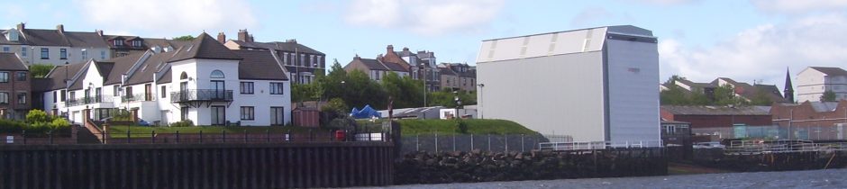
Boats come up the slipway from the river so the gable must be the river end of the shed and not the landward end as suggested by the Planning Manager in January 2014;
Example 2.
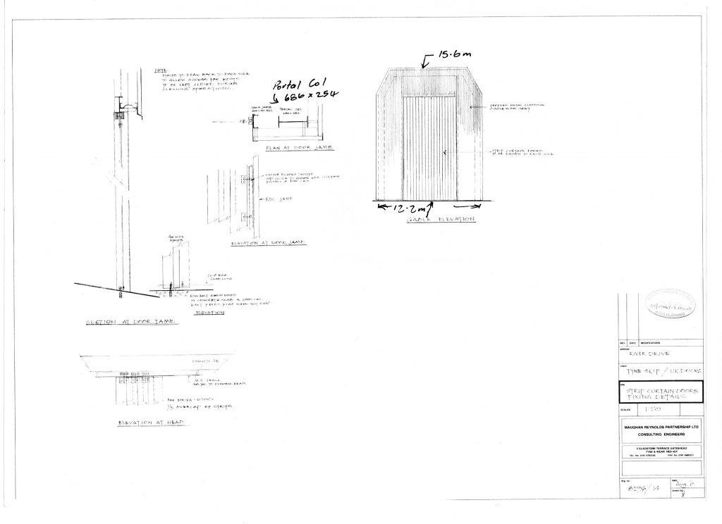
#37. Mr X says plan 14 shows 15.5 metres as the river end height. The Council has explained to Mr X why this is not the case. The developers submitted plan 14 in 2013 as part of their application to discharge condition 4.The developers submitted plan 14 in 2013 as part of their application to discharge condition 4. The Development Corporation did not approve plan 14 in 1996 and it is not a plan subject to condition 2. [1] One drawing shows an end with the panels in place to provide an impression of the final appearance. The drafter has not specified which end this is and the drawings are not to scale[2].
The drafter said that portal covers should be drawn aside to admit boats and they come up the slipway from the river!
- The Planning Manager approved 8296/14 in October 2013;
- The Planning Manager went on to say that the drawing was not to scale but it is drawn fairly accurately to a scale of 1:100.
Example 3.
#34. I have seen the 1996 plans. On plan 1/B the applicant has written the proposed elevations at the inland end as 12.5 metres plus 3 metres [1]. Mr X says the Council should not have taken the applicant’s word for this. The planning authority has to consider what an applicant applies for; it can grant or refuse this but it cannot make an applicant submit something different. This developer applied for a shed 15.5 metres high at the land end. The Tyne and Wear Development Corporation as planning authority approved this [1]. The current Council had to accept this as the approved height.
See #30 or 33. 1B and 1A are interchangeable, both show the same error and neither have been authorised, contrary to what the senior planning officer has told the Local Government Ombudsman.
- Note from Planning Manager 15-Jan-14 “8296/2. This drawing is stamped ‘Approved by Tyne and Wear Development Corporation date 8/7/96 22/8/96’. There is no explanation as to why two dates are shown. the 1st two drawings mentioned under ‘Approved Drawings’ were not approved.
- there is no indication on this drawing that it has ever been to the Tyne and Wear Development Corporation.
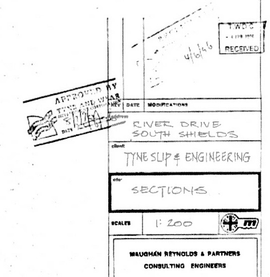
Authorisation stamp of the T&WDC – from 8296/2 in the Council’s possession. It gives a planned height of the landward end as 12.7m