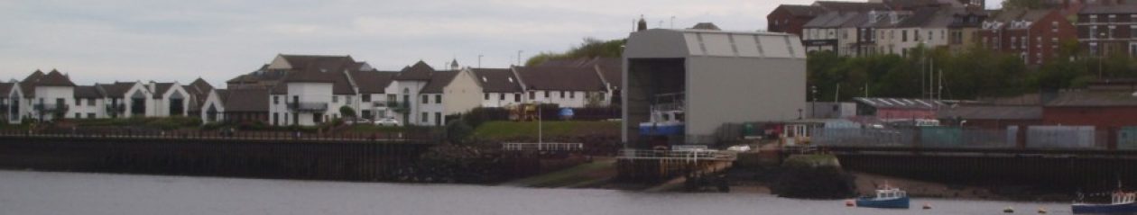
There are 2 drawings that survived from 1996 in the Council Archive 8296/2 and 8296/4 that have been approved and the second does appear to give approval to the shed finished in 2014 using the gradient as calculated below i.e. 15.5m at the landward end.
The first, using the same maths produces one that is 12.7m at the landward end which is neatly coincides the the dimention given on it. Drawing 8296/1A gives the datum height of the feet of the shelter as:
- river end = 93.444m
- landward end = 96.100m
The gradient is therefore = 2.656m
Using this on drawing 8296/2 to scale the ‘enclosure’ on the longitudinal section through site, the river end of the enclosure is found to be 15.4m and the landward end, 12.7m.
This accords with the drawing 8296/1A which is shows a river end of 15.5m and one can say that 1A represents the approved height if one corrects 12.500 dimention. It should be about 9.84m which was why it was not approved.
Note:
- 8296/2 was been authorised by T&WDC in 1996. The Council have not provided an authorised copy of 8296/1A and it is probably safe to assume that it was not authorised.
- Confirmation of river end 16m and the road end 13m can be made by using the length of the shelter from 8296/1A (22m).
- The publication of drawing 8296/14 (drawn August 13 by the Agent) by the Council in October 13 gives the river end as 15.5m. This is further confirmation that the road end was planned to be 12.5m high.