There are two drawings that show a height for the landward end of the shed of 15.5m and neither were approved because it was a mistake made by the draftman in 1996. Why the Council do not hold a corrected one has never been explained but it matters not because there is one approved drawing from 1996 that survived and it is 8296/2
The detail used by Planning, repeated by the Head of Development Services in his response to our Petition is a mistake on a drawing 8296/1A or 1B and in his fraudulent Stage 2 responses is a mistake on a drawing 1A.
After the shortcomings of 1A, see below, were pointed out to the Ombudsman South Tyneside Council reverted to the use of 1B.
8296/2
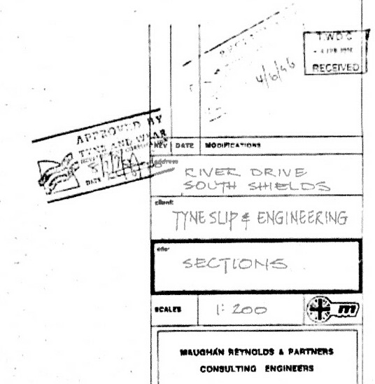
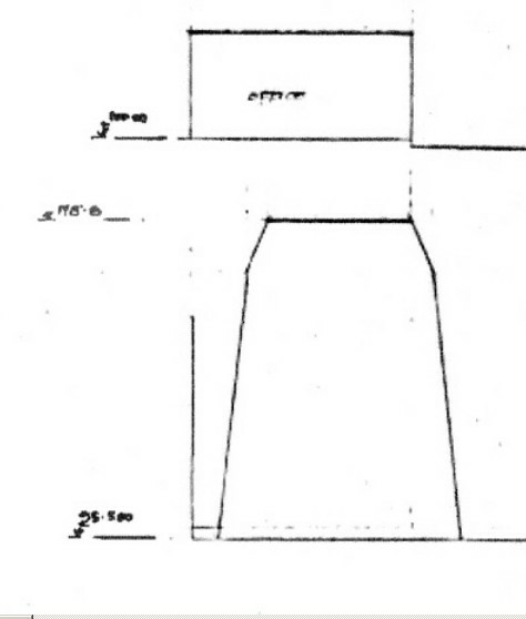
8296/2 is the only authorised drawing from 1996 in the Council’s possession with dimensions. The detail on the left hand side gives an approved height of the landward gable of 12.7m.
Even where these heights have been removed from the drawing as in the case of the copy sent to the Planning Office on day 2, one can still estimate the true planned height by using the gradient on the elevation of the shed. It makes the river end about 16m and therefore a landward end of about 13m. Not the 15.5m measured in September 2013.
8296/14
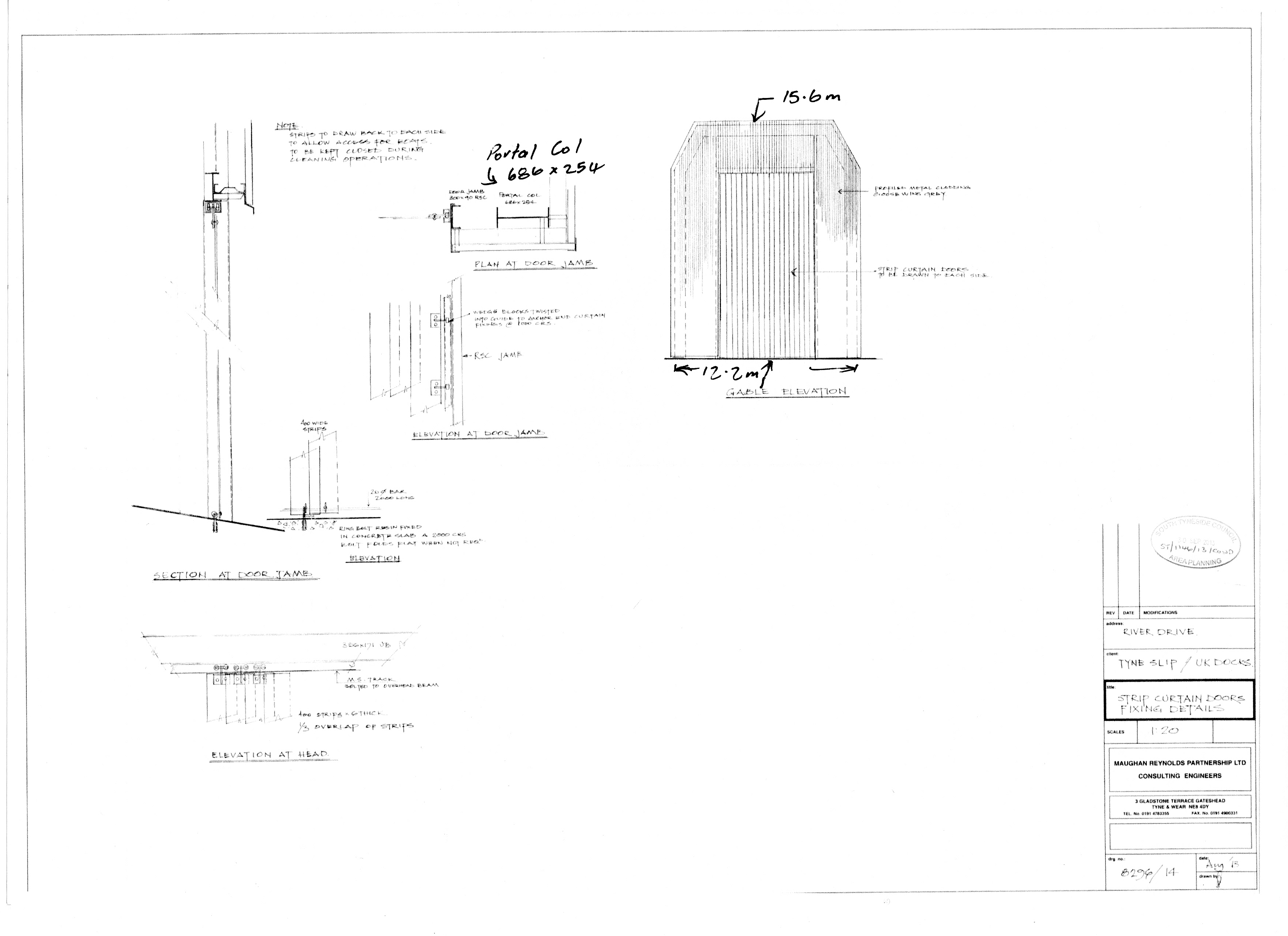
One should perhaps use this drawing rather than 8296/2 because it would have included any authorised amendments made since 1996 and was approved by the Council 14-Oct-2013.
It includes the change in angle of the sides. The main thing to notice is that the planned height of the landward end was not changed and remains at 12.7m, the gable end on the drawing being about 16m.
8296/1A and 1B
The drawings used by UK Docks and their promoter South Tyneside Council are either 8296/1A or 1B which are not authorised and both contain the same fundamental drawing error.
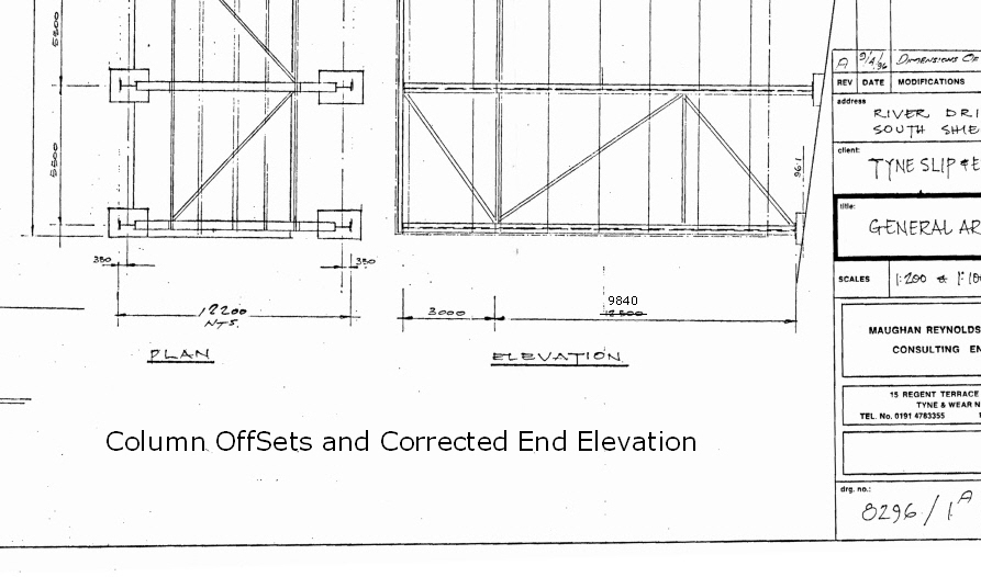
Even without using a scale ruler on a full sized drawing one can see that the dimension at the landward elevation of the shed is wrong. The 3000, roughly a quarter of the whole, nearly half way to a mid point line, confirms this and three is a quarter of 12 not 15.
The River End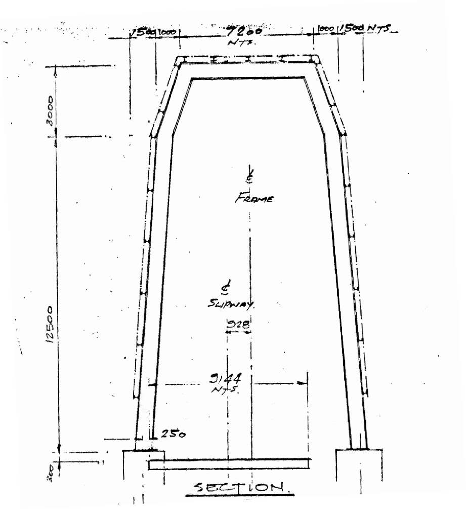 The first drawings seen did not show the true height of the river end.
If one looks at the top of either drawing one will see that the river end is shown as 15.5m as well and as there is a gradient (2.7m) between the ends and only one of them can reflect the planned height of the roof or the roof would slope downwards toward the river. It does not, so the landward end = 13.3m (river end – gradient) which agrees with the authorised drawing from 1996 – see 8296/2 at top.
Shed height from detail on 8296/2: Authorised 1996

Neither 1A nor 1B were approved and anyone who says or implies otherwise is intending to misinform; 8296/1B was an amendment made to 1A in 1997 and sent to the Ombudsman as an approved document from 1996 to compound the lie.
In the response to our Petition, the Head of Development Services referred to, a non-approved drawing, implying that it was approved. It was 8296/1A and was not approved as the landward end had been incorrectly given as 15.5m.
What the Planning Manager had not told his boss was that the drawing showed the river end to be 15.5m as well.
The side elevation from 8296/2 using the heights from the river end detail on 8296/1A or 1B gives a value of 12.8m for the landward end of the shed. The first copies of 8296/2 given out, had the vital dimension at the landward end had been removed (height of the roof at 108.8m above footings at 96.1m = 12.7m).