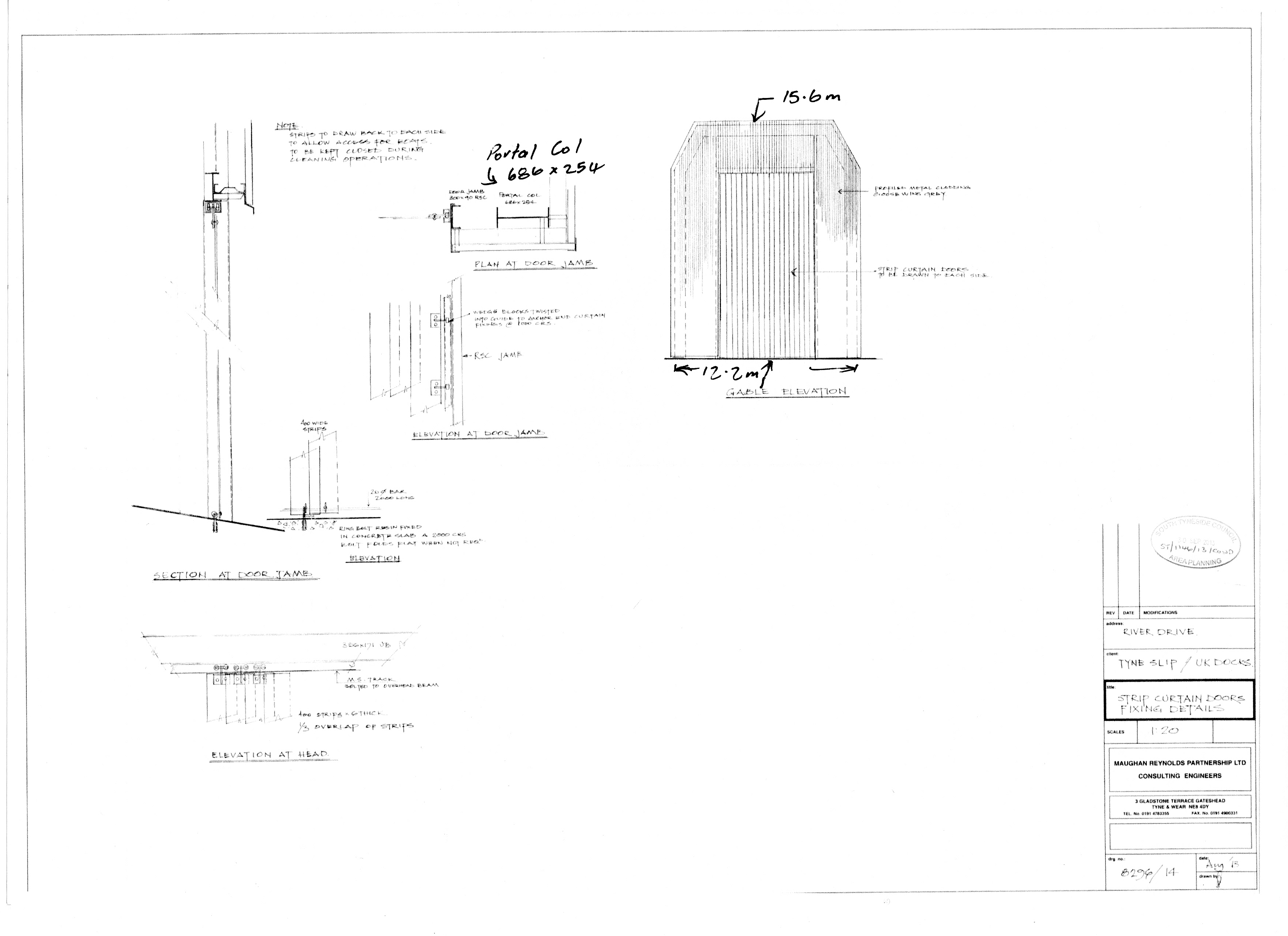
This was approved by the Planning Manager on 14th October 2013, ST114613COND Decision Notice.pdf, and the height and width can be gauged by scaling using the portal columns and roof beam.
The gable end is drawn to a scale of 1:100 and is about 16cm high.
More easily, the height could have been found from river side gable end on the A1 drawing sent to the Council for the approval of condition 4 but the detail shown on 8296/14 will have to do.

In case there is any confusion about which end of the cover is being referred to in this drawing, the cladding is designed to go on the outside and is shown on the down side of the portal column. If the drawing referred to the road end gable end it would be shown on the upside of the portal column.
More importantly there is a note on the drawing “strips to draw back to each side to allow access for boats” and the boats come up the slipway from the river.
When this was drawn in August 2013, one has to assume that the draughtsman had referred to the authorised plans from 1996 and the Legal Section of South Tyneside Council tend to confirm this. In the last stage of their complaints procedure before submission to the Local Government Ombudsman, Customer Advocacy said:
I have not considered this point further because it is clear that drawing 8296/14 . . . could never supersede the previously approved plans in terms of defining the dimensions of the approved development.

Pingback: STC and Corruption: Petitions | Harbour View
Pingback: Hiding Duplicity | Harbour View
Pingback: Shed and Corruption – Part 20: A summary of 1-19 | Harbour View
Pingback: UK Docks Slipway Enclosure | Harbour View
Pingback: LGO Findings paras 30-38 | Harbour View
Pingback: Email to Councillor Hamilton 27-Mar-19 | Harbour View
This drawing should have put paid to any notion that the shed had been built to the permitted height but it did not because of the misuse/abuse of the complaints procedure by the Planning Officers involved.
It was also the drawing presented to the Ombudsman.