is in the Subject:
From: Principal Planning Officer
To: Greens Place Resident
CC: 7 Local Residents; cllr.john.anglin@southtyneside.gov.uk;
cllr.audrey.mcmillan@southtyneside.gov.uk; Cllr.John.Wood@southtyneside.gov.uk;
Mike.Telford@southtyneside.gov.uk; Gordon.Atkinson@southtyneside.gov.uk
Date: Mon, 9 Sep 2013 13:08:28 +0100
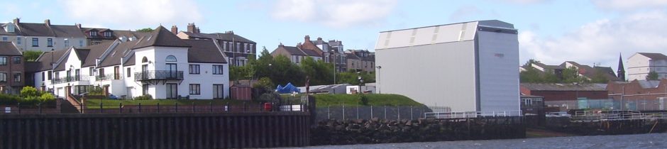
Subject: Approved boat repair shelter at Tyne Slipway, River Drive, South Shields [NOT PROTECTIVELY MARKED]
Hello
I called on site last Friday (6/9/13) and following this visit the applicant provided me with 2no. Architect drawings (copies attached) which were agreed as part of the 1996 planning permission. The development shown on these plans is being constructed on site.
The same Architect that submitted these plans in 1996 is overseeing construction on site today and he has used these drawings under the Building Regulations submission.
My colleague, the Snr. Building Control Surveyor, Mike Telford (Tel: 4247000) is dealing with the Building Regulations application.
You may be aware the Building Regulations system is there to ensure that development is constructed in accordance with modern day building standards, they are not dealing with residential amenity issues such as outlook as this would be a planning issue.
The details relating to condition 4 were agreed by the Tyne and Wear Development Corporation, whom were the planning authority for the area in 1996 not South Tyneside Council.
Unfortunately, only recent planning records are held on the Council’s Planning Portal website, but when residents call I am either emailing or posting the information regarding this development out to them.
Give me a call if you require more information
Best Regards
Principal Planning Officer
The item of misinformation is in the title. The boat repair shelter is not approved. It has been built without planning permission.