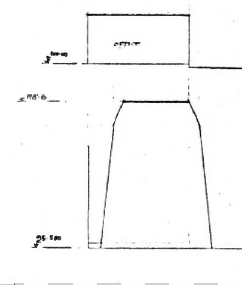
The first detail is from a copy of a drawing 8296/2 retrieved from South Tyneside Archive in September 2013. It has been authorised by the T&WDC and although not particularly legible the height of the enclosure (cover) is shown as 118.8m. The 95.5m is a survey point some meters down from the road end survey height of 96.1m. The arithmetic gives a road end height of 12.7m
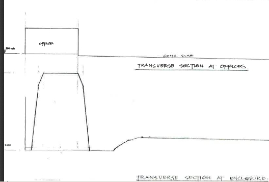
The second detail is from drawing supplied to the Council by UK Docks on September 6th 2013. It does not include the details shown above. They have been removed and the 500 had to remain a mystery for five months. It is the base height (95.500m) of the transverse section of the enclosure taken about 5m down the slipway from the landward end.
When the Council finally produced the copy of 8296/2 which was not cropped, it only went to confirm the height from the drawing produced by the agents – Maughan Reynolds Partnership Ltd – 8296/14. This gave a height of about 12.7m at the road end.
River End Detail of 8296/1B added in 2019:-
Missing height (12.5m) to hip of mansard from earlier drawing 8296/1A giving total height of 15.5m.
Pingback: An Inescapable Truth | Harbour View