This drawing, 8696/1B, was given to the Case Officer on the 6th of September 2013 by a representative of UK Docks and was accompanied by a cropped version of 8296/2. Neither drawing showed any evidence of having been to the Tyne and Wear Development Corporation. Neither was authorised
The first thing to notice about 1B is that both ends of the enclosure have a shown height of 15.5m which is clearly an impossibility. The datum heights of the feet of the shelter are given as 93.444m at the river end and 96.100m at the landward end respectively. This gives a gradient of 2.656m.
The use of 1B (and later 1A) to claim the road end height of the enclosure of 15.5m was probably illegal considering the agents had produced a drawing in August showing the river end to be 15.6m high and to quote Customer Advocacy:
I have not considered this point further because it is clear that drawing 8296/14 was submitted in 2013 for a wholly different purpose (i.e. for the purposes of discharging a planning condition) and as such, could never supersede the previously approved plans in terms of defining the dimensions of the approved development.
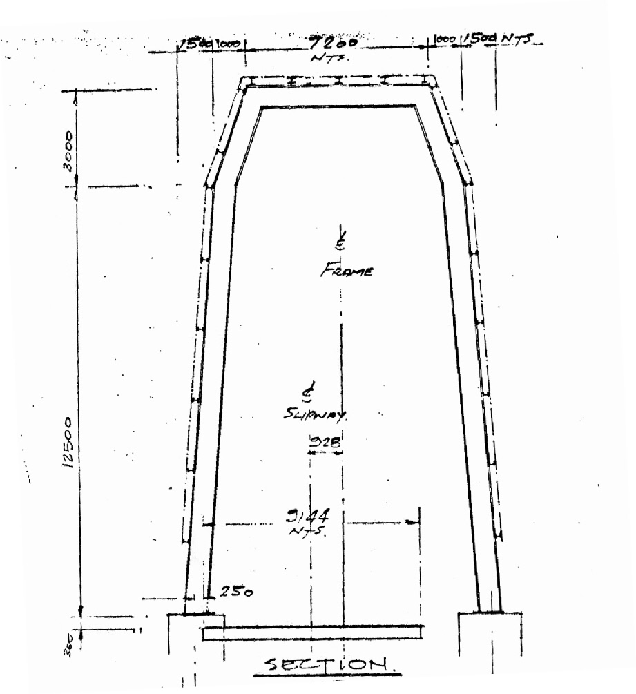
Even without considering 8296/14, it can be shown that the dimensions of the landward end are probably incorrect. The river end shows a height of 15.5m and by inference a road end of 12.8m. It can be seen that the draughtsman has made an error in dimensioning the road end.
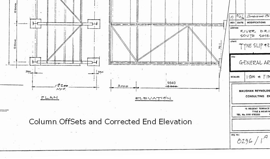
Anyone with an open mind would say that the specification was for an enclosure of about 13m at the landward end when the shed was planned in 1996. It would seem reasonable to say that the same specification was used to draw the plan in August 2013 and its detail 8296/14.
A variation of this explanation (applied to 1A) was sent to the LGO but was ignored.
There is another argument against the landward end being 15.5m. Using a gradient of 2.656m to scale 8296/2 it gives ends of 13m and 16m. 8296/2 is authorised.