Drawing no. 8296/14 is a recent drawing submitted to discharge condition 4 and it shows the strip curtain doors fixing details
Drawing no. 8296/14 is a recent drawing submitted to discharge condition 4 and it shows the strip curtain doors fixing details.This drawing has been used to point out that the shelter has been built 3m too high. There is no confusion as the elevation is clearly the river end. The drawing 8296/14 gives a detail of a beam (portal column) width 0.686m, so the height and width of this elevation (north elevation, the riverside end) can be gauged. This elevation in the drawing has a height of 15.6m and a width of 12.2m.
With regards to condition 2, this does not require any submission by the developer.
The first two conditions of the grant of planning permission given in 1996 are:
1. The development to which this permission relates shall be begun not later than the expiration of five years beginning with the date of decision.
2. The development to which this permission relates shall be carried out in complete accordance with the approved plans and specifications.
These two conditions are so fundamental to any planning decisions they are or should be a given. That is, there should be a time limit on when a start is made and that the developer should build what they say they are going to build or go back apply for permission again. [hence its prominence in the complaint and the commentary]
The variation in the angle of the pillars is not considered to be material. That the dismissal of the slope or angle of pillars as immaterial is questionable considering the extra width gained at the height of the travelling crane. The extra width at this height because the pillars are now vertical is 3 meters and the extra meter gained in 2001 at the footings gives an overall increase of 4 meters. Any observer would say that the shelter in no longer just a cover but is now a housing for a travelling crane.
This drawing is stamped ‘Approved by Tyne and Wear Development Corporation date 8/7/96 22/8/96’
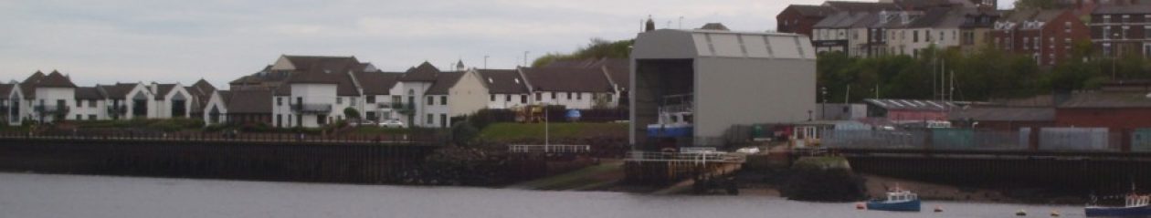
A second drawing was received by TWDC on 4th June 1996 from the developer’s agent. That is numbered 8296/2. This shows longitudinal and transverse sections through the site to illustrate the relationship between the proposed building and the gradient of the site, the riverside revetment and existing buildings on the site.
Using either the fact that the gradient is 2.565m or the length of shelter is 22m long one can work out the height of the ends.
The road end is 13m and the river end, 16m. This is further substantiation of the planned height of the shelter is 12.5/15.5m and not 15.5/18.5m.
That shows the overall height of the structure as 15.5m above the foundation level at the landward end. At the riverside end the foundations are shown as 2.656m lower due to the gradient of the slipway. The structure would therefore be that much higher at the riverside end.
He omits the fact that drawing 8296/1A shows quite clearly that the height of the river end is also 15.5m. Both ends cannot be 15.5m high if the roof top is level and there is a gradient of 2.656m. Careful examination of 8296/1A shows that the river end being 15.5m high is a more likely explanation than the Planning Manager’s of the road being that high.
The Planning Manager has been disingenuous in his explanation and it does not stand up under investigation. Variations of this have been repeated, principally by the Head of Development Services and he uses it as the reason to take no action, he maintains there is no material difference in height, against UK Docks for not building the shelter to plan. It also appears under various guises in correspondence over the next 15 months:
1 – [6] A further inspection on 22nd May 2001 showed that the foundations were fully concreted.
A meter wider than the plans allowed. It so happens that a 5 ton travelling crane fits the new frames exactly when hoisted into place some 13 years later. The frame sides are not to plan either, they are vertical which adds an extra three meters.
The internal width of the shelter at the height of the crane is now of the order of 11.5m where it was 7.5m. This is over half as much again. This a non-material deviation according to the planning office.
Your details have been passed to the appropriate team and will be read then actioned as appropriate. If a response is required a member of the relevant team will contact you as soon as possible.
Your confirmation details
Reference:
274396
Name:
Mr Dawson
Email:
mick.dawson@theharbourview.co.uk
Complaint:
On Friday 3rd July 2015 I wrote: “Feedback case 248789 and Complaint 253539. I have tried to look these up and failed. They are a follow up to a complaint I made in January 2014 about the height and width of a shelter built on River Drive in South Shields.” Please acknowledge the receipt of this complaint.
[0] My understanding is that the responses that I had provided to you at this meeting enabled the matter to be closed.
I recall the meeting very well, it is one of the reasons this website exits. He said the cover was built to approved plans and is the first item in denials.
I did speak to the Chair of the TGA at their next committee meeting and he did not believe me and he declined my offer to show him how I had ascertained the width without access to the site. However it was agreed at the meeting that he would check width with the Council and report back – there is no evidence that this was ever done.
I was not happy with Mr Cunningham’s response especially his reference to the complaints procedure. This means he avoids having to explain why the Council had allowed work to continue on the shelter despite it not being built to approved plans. See evasions where he deflects a direct question about the height.
The Planning manager said at the end of the paragraph on drawing 8296/14, “The north elevation is 15.6m high with a width of 12.2m.” He is totally wrong – the north elevation is the landward or River Drive end of the shed.
The detail is the downward end, south end or river end.
the cladding is on the outside
note saying . . . . to allow access for boats.
Examination of this drawing number (8296/14) gives a detail of the beam and portal column, depth or width of 0.686m, with which the height and width of the north elevation can be gauged(15.6 and 12.2m). This means that the other end, south or landward or road end, would have a planned height of 12.5m.
I have estimated that that the width of structure is 13.2m the drawings detail 12.2m.
The Planning Office were saying that “The dimensions of the steelwork have been checked on site and they are in accordance with the measurements shown on the approved drawings. The variation in the angle of the pillars is not considered to be material”.
This was in January 2014 – they had known the width of the shelter to be 13.1m since September.