Emails 14-Jan 2014 to 28-Jan 2014
From: Michael Dawson
Sent: 14 January 2014 14:47
To: Peter Cunningham
Subject: Slipway Development – Work Continues
Dear Mr Cunningham,
Thank you for your message. As you no doubt observed my message was sent to the Planning Department in general and not to you specifically. However out of courtesy I will respond.
Firstly I was contacting planning not under the umbrella of the Tyne Gateway Association, but as an individual and resident of Greens Place.
Much as I appreciated your meeting with the above mentioned Association I am personally not satisfied with the outcome, particularly as new issues have come to light. The issues I refer to are the date stamp on drawing no 0296/1A and drawing for application ST/1146/13/COND which is not a match for the current structure.
Therefore until I have some satisfactory answers to my very reasonable questions I do not consider this matter closed.
If you are unable to supply me with answers to my questions could you please pass the issue to someone who can.
sincerely
Mr M Dawson
The initial response by the Planning Manager – 15 Jan
was to agree with his Principal Planning Officer, “The dimensions of the steelwork have been checked on site and they are in accordance with the measurements shown on the approved drawings [Denial-4]“.
he also says a few things in this response which have, as it transpires, some significant import and these are dealt with in responses to enquires.
Receive Authorised Drawings and given Dimensions – 28 Jan
Authorised drawings 8296/2 & /4 are attached with the the explanation:
“The Council was contacted by local residents in early September 2013 when the steelwork erection commenced. We weren’t able to immediately identify the archive case and the company provided from its own sources copies of drawings numbered 8296/1B and 8296/2[1], which is why those drawings are stamped received by us 6 Sep 2013. Following a search of our archived file the only drawings that we have that are stamped ‘Approved by Tyne and Wear Development Corporation’ are 8296/2 and 8296/4[2]. 8296/1A and 8296/1B are consistent with these two stamped drawings in terms of overall dimensions. It is therefore reasonable to say that 8296/1A, 8296/1B, 8296/2 and 8296/4 represent the development which was approved in 1996 (the only difference between 1A and 1B being to the foundation detail[3]).
8296/2 and 8296/4 are the first authorised drawings provided by the council and they appear to have been sitting on them for some time.
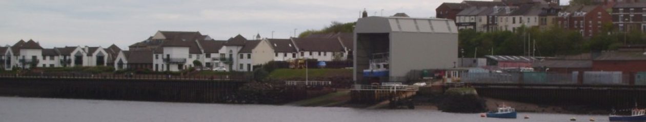
Dimensions of the shelter are as measured by the Council in September:
Length 22.254m;
Width 13.1m [4];
Height at end facing River Drive 15.5m”.
He has totally misread the 8296/14 and I could not allow this to go unchallenged when he said in the third paragraph that I have seem to have assumed the elevation is the riverside end.
“8296/14 is the recent drawing and the only purpose of that is in regards to the condition dealing with the strip curtain door fixing details. You explain that you have measured the height from this drawing as 15.6m, and you seem to have assumed that is the riverside elevation[5], and have adjusted for the gradient of the slipway and concluded that the height at the River Drive side should be in the order of 3m less. In fact the 15.6m height is the height to River Drive and the height on the river side is some 3m greater[6].”
I write to him again saying there are notes saying that the elevation is riverside end and he then admits that that the shelter was not built to plan.
He concludes by reference to the ‘Complaints System’.