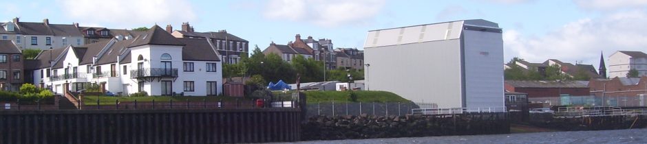
There are two in existance which are relevant to the height of UK Docks’ Shed on River Drive South Shields, one authorised in 1996 (8296/2) by TWDC and one (8296/14) approved by the Planning Manager in 2013.
Authorised Drawing 8296/2
This was one of a set of drawings recovered from the Council’s archive in September 2013 and to quote the Planning Manager; “Following a search of our archived file the only drawings that we have that are stamped ‘Approved by Tyne and Wear Development Corporation’ are 8296/2 and 8296/4.”
108.8m – 96.1m = 12.7m
He goes on to say; “It is therefore reasonable to say that 8296/1A, 8296/1B, 8296/2 and 8296/4 represent the development which was approved in 1996 (the only difference between 1A and 1B being to the foundation detail).”
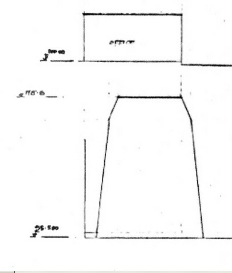
He has not mentioned that both 1A and 1B show both ends of the shed to have the same height of 15.5m which is an impossibility and why neither has been authorised.
The height of enclosure at the landward end is 12.7m (96.1m is the height at the foot of the columns) which shows that the use of either ../1A or ../1B to claim an approved height of 15.5m for the landward end:-
- is unreasonable*;
- deceitful and probably fraudulent.
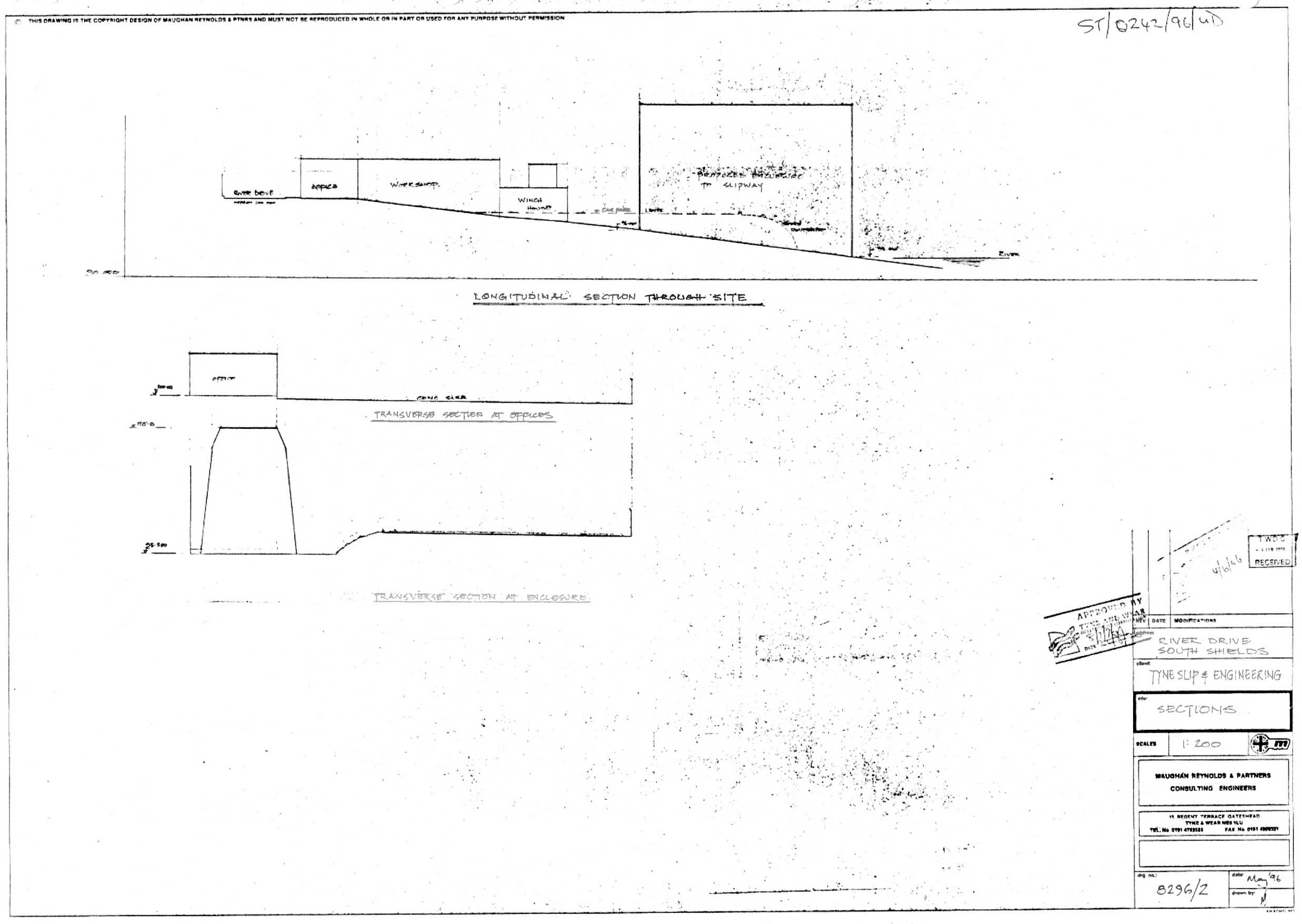
* because only one end of the shed can can have a planned height of 15.5m or the top of the shed would slope down towards the river with the same gradient as the slipway. The approved drawing, 8296/2, shows it is not the landward end.
Approved Drawing 8296/14
This was approved by the Planning Manager on 14th October 2013, ST114613COND Decision Notice.pdf, and the height and width can be gauged by scaling using the portal columns and roof beam.
More accurately, the height can be found by measuring the gable end in the A1 drawing sent to the Council for the approval of condition 4. The drawing is drawn to a scale of 1:100 and is 16cm high.
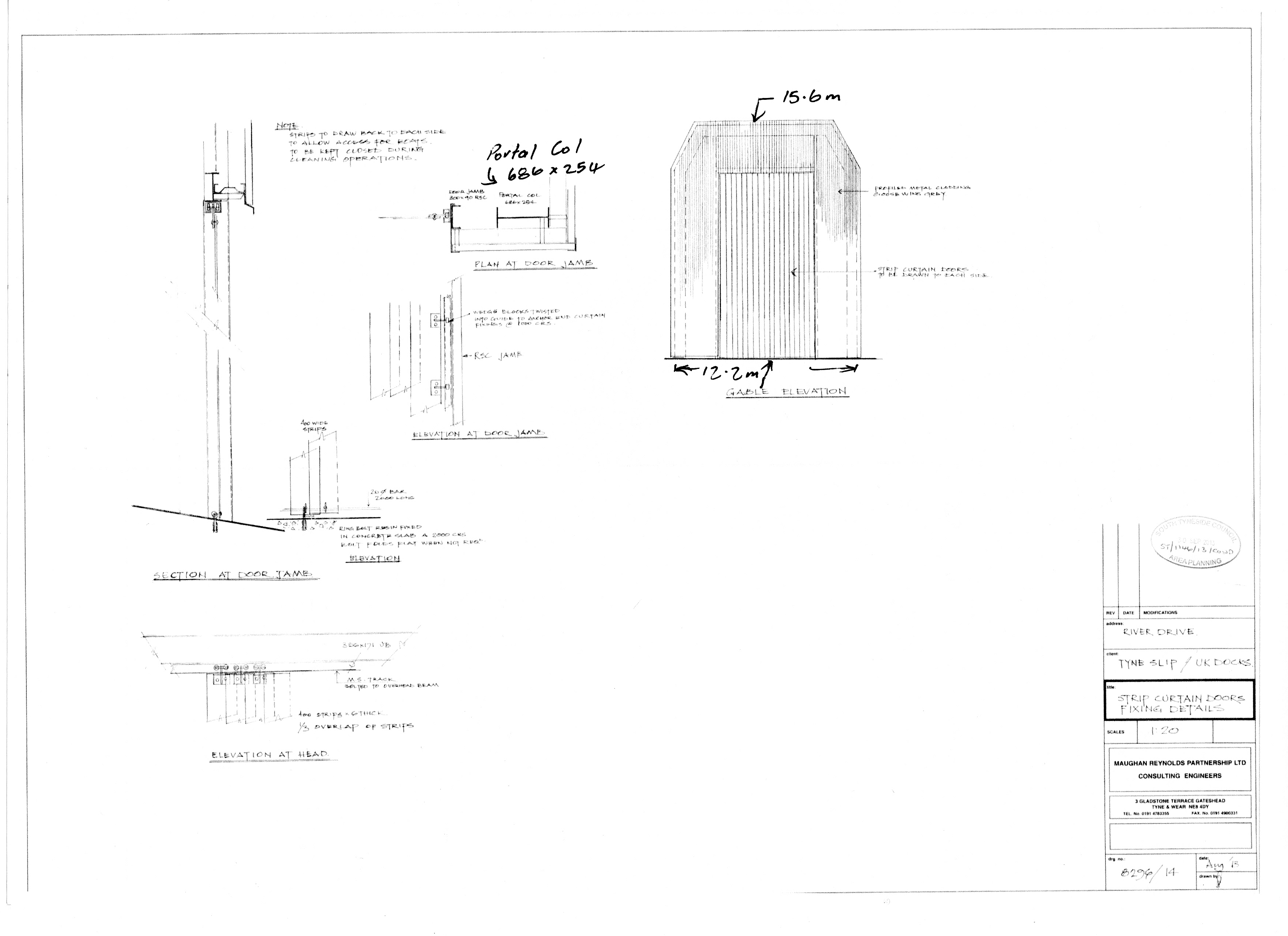
In case there is any confusion about which end of the cover is being referred to in this drawing, the cladding is designed to go on the outside and is shown on the down side of the portal column. If the drawing referred to the road end gable end it would be shown on the upside of the portal column.
More importantly there is a note on the drawing “strips to draw back to each side to allow access for boats” and the boats come up the slipway from the river.
When this was drawn in August 2013, one has to assume that the draughtsperson had referred to the authorised plans from 1996 and the Legal Section of South Tyneside Council tend to confirm this. In the faux Stage 3 response by the Council, the author on behalf tof the Chief Executive failed to mention the height of the shed altogther.
She did this by dismissing the drawing approved by the Planning Manager but she does say that:-
I have not considered this point further because it is clear that drawing 8296/14 . . . could never supersede the previously approved plans in terms of defining the dimensions of the approved development.
The previously approved plans included 8296/2